
Monongalia County ZIP Coverage
The working coverage set below comes from USPS facility and label sources plus county references. It is a research aid, not an official boundary table. The interactive USPS tool did not expose a complete county list during research, so every Monongalia County address still needs a By Address query. Place names describe delivery associations and may cross municipal or county lines.
| ZIP Code | Areas Covered | Post Office | Notes |
|---|---|---|---|
| 26501 | Morgantown and Westover-associated delivery | Morgantown | Verify the city label |
| 26502, 26507 | Morgantown alternate postal use | Morgantown | PO Box or alternate use appears in references |
| 26504, 26505 | Morgantown, Star City, central county | Downtown and Star City | Routing history; not place proof |
| 26506 | Morgantown and WVU | University-associated | Use the exact address |
| 26508 | Morgantown, Suncrest, Brookhaven area | Morgantown-associated | Working coverage only |
| 26521, 26527 | Blacksville, Spraggs, Cassville | Cassville for 26527 | Rural and community delivery |
| 26531, 26534 | Dellslow and Granville | Granville for 26534 | Exact address required |
| 26541, 26543, 26544 | Maidsville, Osage, Pentress | Community routes | 26541 has routing history |
| 26546, 26590 | Pursglove and Wana | Pursglove for 26546 | Verify current postal label |
Morgantown labels appear across several codes, while Granville, Cassville, Pursglove, and other communities have their own postal anchors. University and PO Box uses need special care. A ZIP code directory can sort mail geography, but only an exact query can confirm the label for one address.
Search Monongalia County USPS Records
The USPS ZIP Code Lookup offers three distinct routes. By Address answers which postal form belongs to one street address. By City and State returns ZIP codes associated with a place label. Cities by ZIP reverses the question and lists the city names attached to a code. USPS warns that its result does not confirm that a named person or company occupies the address.
| USPS mode | Input | Best use | Limit |
|---|---|---|---|
| By Address | Company optional; street required | Confirm one delivery label | Not a resident check |
| By City and State | Place and West Virginia | Find associated codes | Not a boundary map |
| Cities by ZIP | Five-digit code | Review accepted place labels | Does not prove jurisdiction |
If a business form fails, USPS recommends trying a different company-name version. For a residence, retain the exact street spelling, unit, and returned city line before moving to county sources.
Find Monongalia County Residents by ZIP
No ZIP field was located in either the Monongalia County Assessor form or the statewide assessment search. Do not imply those portals can return a ZIP-wide resident list. Use the ZIP code directory as the postal first pass, then switch to exact-address or owner tools. The WV Parcel Viewer accepts an E-911 address, owner name, or parcel number and supplies the physical parcel context.
- Run USPS By Address and save the standardized street, unit, city label, and five-digit code.
- Search the WV Parcel Viewer by E-911 address. Save the owner, physical address, county, district, map, and parcel identifiers.
- Check the county assessor by street, city, owner, or district and parcel. Keep postal labels separate from assessment fields.
- If lawful election research is needed, use the official voter lookup or request route and follow West Virginia limits.
Once the postal area narrows to one road, the Monongalia County street directory explains the address and parcel chain in full. A name match or mailing city alone is never proof of current residence.
Monongalia County Postal Anchors
Four official USPS locations add useful ground points to the working postal list. They are postal facilities, not neighborhood borders. Hours and services can change, so check the official location page before visiting or mailing a time-sensitive request.
Downtown Morgantown
40 High Street, Suite 101
Morgantown, WV 26505-9998
304-291-1036
Star City
3400 University Avenue
Morgantown, WV 26505-9994
304-599-5769
Granville
524 Main Street
Granville, WV 26534-9998
304-599-5075
Pursglove
576 Blue Horizon Drive
Pursglove, WV 26546-9998
304-599-5675
Cassville is another verified anchor at 778 Mason Dixon Highway, Cassville, WV 26527-9998, phone 304-328-5511. The facility name supports postal routing only. It does not decide municipal limits, tax district, or precinct.
Morgantown ZIP Routing History
USPS label materials connect Morgantown with 26501, 26502, 26504, 26505, 26506, 26507, 26508, and 26541. Postal bulletins add dated routing clues. A 2013 bulletin added 26541 to Morgantown 26505 routing, while a 2015 bulletin showed 26505 routing toward 26501. These notes help explain why an old letter or directory may not match today's label.
Treat the old ZIP as a date clue. Check the address in the current USPS tool, then compare the street and parcel. Never convert the historical label in a transcript without preserving what the source actually printed. That practice keeps the postal trail useful for family history without turning a routing instruction into a claim about where someone lived.
Check Monongalia County Parcel Geography
The WV Parcel Viewer is the next check after USPS. Search modes include E-911 address, owner name, and parcel number. A result can show current owner, physical address, county, district, map, parcel, flood indicator, description, building information, and assessment links. The viewer has a 500-result cap and an annual update cycle.
A successful project capture shows the mobile parcel viewer entry point.
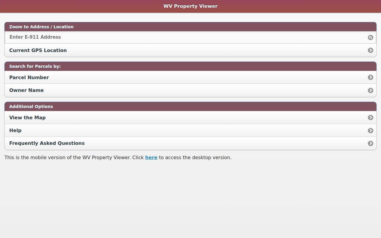
The image connects the ZIP lookup to physical parcel research. Tax parcel lines are a map aid, not a legal boundary survey, and the physical address may differ from the owner's mailing address.
Monongalia County ZIP Place Names
Monongalia County has far more named communities than postal city labels. Official state listings include Blacksville, Booth, Brookhaven, Cassville, Cheat Lake, Core, Dellslow, Granville, Maidsville, Osage, Pentress, Pursglove, Star City, Suncrest Lake, Wadestown, Wana, Westover, and many smaller places. A searcher may know the local community name even when USPS returns Morgantown or another post-office label.
Preserve both names in notes. Use the USPS form for mail, the physical-address field for parcel research, and the district or municipality shown by the responsible government source. Do not replace a historic community name just because it is absent from the present mailing line. That older label can lead to newspapers, church records, school material, maps, and archival catalogs.
Rural routes and post-office boxes need the same care. A PO Box can receive mail without locating a home parcel. If a box number is the only known item, contact the named postal facility for current addressing rules, then seek a lawful physical-address clue in a deed, directory, public filing, or family record. Do not infer a street from the box.
Compare Monongalia County ZIP Evidence
Official sources do not all describe the same place. USPS standardizes delivery. The WV Parcel Viewer maps tax parcels and E-911 addresses. The county assessor maintains current and historical assessment details, while the County Clerk records deeds and other instruments. Voter information follows election law and can omit fields that are not public. A commercial directory may merge these layers without showing when each was updated.
| Source | What it can confirm | What it cannot prove |
|---|---|---|
| USPS lookup | Current postal label for an exact address | Occupant, ownership, or city limits |
| WV Parcel Viewer | Parcel and physical-address context | Legal boundary survey or present occupancy |
| County assessor | Assessment owner, map card, and parcel history | Every resident at the site |
| Commercial directory category | A possible lead assembled from mixed sources | Official status or reliable update date |
For a personal family, estate, or property question, cite the official record used and its access date. Never use a broad postal result to contact, track, or harass a person. A ZIP code is a sorting tool, not permission to treat every name in the area as a match.
Monongalia County ZIP Boundary Limits
A ZIP code follows mail delivery, while Morgantown city limits, Monongalia County lines, census places, tax districts, wards, and voter precincts serve other purposes. One street can carry a Morgantown mailing label outside the city. A county place can also use a nearby post office's name. This mismatch is normal and is the main reason an exact-address check must lead any ZIP code directory search.
- ZIP and ZIP+4
- The five-digit delivery area and an added four digits that sort a smaller delivery segment.
- PO Box ZIP
- A code or use tied chiefly to post-office boxes rather than broad street delivery.
- Unique ZIP
- A code assigned for a large organization or institution, such as a university use.
- Carrier route
- A postal delivery path within a ZIP, not a city, tax, or voting boundary.
West Virginia E-911 addressing is another layer. Local offices supply data to statewide systems, but research did not locate a complete public Monongalia County assignment-history portal. When USPS and GIS do not resolve an old or rural form, contact the postal facility and the county or municipal addressing custodian rather than guessing.