
Sources for Monongalia County Neighbors
Public records describe parcels and civic areas more clearly than they describe every household. Begin with the source that covers the immediate block, then label each result by role and date. A map card may identify an owner. It does not list each person who lives there. Likewise, association contacts represent a group, not a private member directory.
| Source | What It Shows About a Block | Access |
|---|---|---|
| WV Parcel Viewer | Visible lots, owner, physical address, parcel ID and map context | Free desktop or mobile viewer |
| Monongalia Assessor and Tax Inquiry | Owner, mailing address, map card, history and tax-ticket role | Online; assessor follow-up |
| County Clerk deed and plat index | Recorded owners, shared plats, easements and legal descriptions | Online index; clerk copies |
| Voter records | Limited public registration fields tied to an address or precinct | State lookup; lawful clerk inspection |
| Morgantown civic maps and associations | Ward, zoning, neighborhood and public group contacts | City pages and meeting routes |
| Directories and Sanborn maps | Dated households, structures and old block context | Aull Center, WVU and digital maps |
Use the viewer for adjacency, the assessor for assessment details, and the County Clerk for title documents. A matching mailing and physical address may support an owner-occupancy clue, but it is not a full household record. Renters, relatives, and other occupants may never appear. A tax-ticket name is a taxpayer role, not a claim about nearby households today.
Read Monongalia Parcel Cards
The WV Parcel Viewer searches by E-911 address, parcel number, or partial owner name after Monongalia County is selected. An address search needs a street address, city, and state. Rural routes and post office boxes do not work in that mode. When an address fails, try the owner or parcel search, or locate the road on the map.
Parcel-number fields are County, District, Map, Parcel, and Suffix. Owner examples use forms such as a surname plus first initial. After a search, zoom until the block is clear, turn on useful Roads or Address Numbers layers, and click each visible lot. The card can display a root parcel ID, owner, physical address, description, building data, cost and appraised values, flood context, and links to an assessment report or PDF map.
The official mobile viewer is shown below. Open its source page to check the current interface.
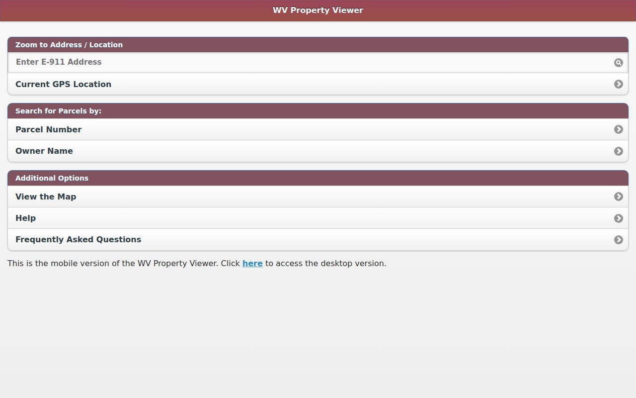
The capture shows the official map route used to move from one parcel to the lots that touch it.
Map a Monongalia County Block
No verified radius or buffer tool was found in the official viewer. The reproducible method is simpler: open the subject lot, zoom to the immediate block, and click outward one parcel at a time. Save each parcel root and source date so another person can repeat the work.
- Search the subject E-911 address in the WV Parcel Viewer. If it fails, try the parcel or partial owner mode.
- Record county, district, map, parcel, suffix, physical address, and displayed owner. Preserve leading zeroes.
- Click every lot that touches the subject lot. Note vacant, business, church, school, or other uses instead of calling each one a household.
- Compare the same parcels in the assessor history and County Clerk deed or plat index. Distinguish physical from mailing addresses.
- Use city GIS only for Morgantown street, ward, zoning, and neighborhood context. Do not treat those lines as title boundaries.
This method answers which recorded parcels surround one address. A whole-road ownership trail is better handled through the Monongalia County street directory, where the search moves by address along the named street.
Monongalia Map Limits Matter
The parcel viewer caps results at 500 and is updated annually. It is a tax visualization, not a legal boundary survey. Surface parcels are shown, not mineral ownership, and deeded acreage controls over a calculated map area. Flood and address-number layers add context but do not establish title or occupancy.
Use the Monongalia Assessor as the authority for assessment questions and the County Clerk as the recording source. The assessor's database recommends partial, case-insensitive owner names and has a separate documented result cap of 1,300. Current and history controls matter because a recent transfer may not yet appear in every system.
Map tip. Keep the district, map, parcel, suffix, legal description, and adjacent owners together when street labels or mailing names disagree.
Morgantown Neighbor Contact Points
The City of Morgantown neighborhood page provides civic contacts and meeting patterns. It names Evansdale, First Ward, Greenmont, Jerome Park, South Hills, South Park Association of Neighbors, Suncrest, Wiles Hill-Highland Park, and Woodburn. The Neighborhood Coordinating Council is the umbrella group. These routes help a newcomer find a public meeting, not private member names.
| Civic area | Official route | Best use |
|---|---|---|
| Evansdale, Suncrest, South Hills | City association page | Meeting and group contact details |
| First Ward, Greenmont, South Park | City association page | Block concerns and civic events |
| Jerome Park, Woodburn | City association page | Neighborhood contact route |
| Wiles Hill-Highland Park | City association page | Association and meeting information |
| Neighborhood Coordinating Council | City umbrella group | Cross-neighborhood civic coordination |
View the official association list shown here.
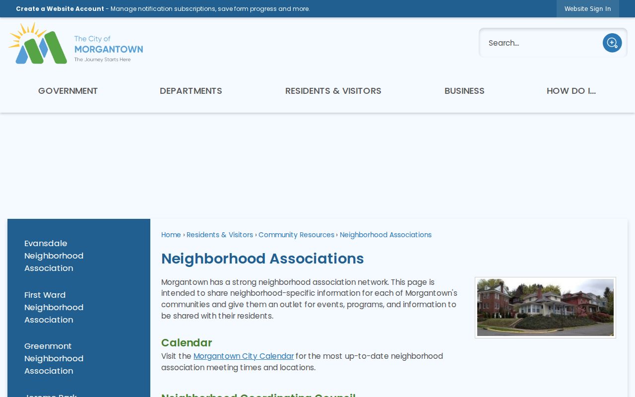
The capture is a civic directory, not evidence that any named person lives within an association area.
Monongalia Neighbors and GeoHub
Morgantown's GeoHub provides maps, apps, datasets, analysis, and downloads for city streets, wards, zoning, representatives, and related civic layers. City GIS is based at 389 Spruce Street and lists 304-284-7405 and geospatial@morgantownwv.gov. Those layers describe incorporated Morgantown, not every part of Monongalia County.
A November 2024 city release described a GeoHub expansion alongside a Cityworks rollout for permitting and asset management. That change is a reason to preserve the source date and ask GIS staff about an old map link. County parcel districts, city limits, civic wards, association areas, and postal labels can overlap without matching. Classify each line before using it to describe nearby residents.
Note: City zoning, ward, neighborhood, and parcel lines serve different purposes and should never be treated as interchangeable boundaries.
Voter Records Around Monongalia Blocks
West Virginia Code §3-2-30 permits inspection of active, inactive, rejected, and canceled voter records during County Clerk office hours. The public minimum includes name, residence address, party affiliation, and status. Printed, read-only, and certain electronic access may be available under the clerk's controls. The statute excludes telephone numbers, email addresses, Social Security numbers, driver's license numbers, and nonoperator identification numbers.
The law also bars commercial or charitable solicitation, advertising, and sale or resale of voter data. Use the official voter-status lookup only for its intended check, or ask the County Clerk what lawful inspection is available. Exact online fields and export limits were not confirmed. Registration status does not prove ownership, continuous presence, or every person at an address.
Official and Commercial Neighbor Results
Official records and commercial neighbor tools answer different questions. One comes from a named custodian with a defined record role. The other may blend old and current data without making the source date or identity match clear. For a Monongalia County block, trace important facts back to the office that created them.
| Point | Official record | Commercial compilation |
|---|---|---|
| Role | Labels owner, taxpayer, registrant, or party | May blur roles into one profile |
| Date | Record or update date can be checked | Age may be unclear |
| Correction | Custodian has a defined contact | Opt-out or correction path varies |
| Block method | Map-click adjacency can be repeated | Radius logic may not be disclosed |
For a disputed owner, consult the assessor and deed. For civic boundaries, ask city GIS. For voter access, use the Secretary of State and County Clerk rules. Source-specific checks are slower, but they keep the result tied to a real Monongalia County record.
Historic Monongalia County Blocks
A present parcel map can be paired with old city directories and Sanborn fire-insurance maps when the question is how a block changed. Documented Morgantown Sanborn years include 1899, 1904, 1906, 1911, 1921, and 1927. The maps can confirm a building footprint, street, intersection, and neighboring use. They cannot identify a person simply because a structure appears.
WVU's Greenmont research on the Pietro brothers shows the method: combine a dated city directory entry with a Sanborn map, a building source, and archival records. No verified official street-renumbering date was located for Morgantown. When an old number will not match, keep the cross street, legal description, footprint, and adjacent owners as stable links.
Privacy for Monongalia County Neighbors
Parcel, deed, tax, and voter sources do not create a complete roster of an address. Renters, relatives, and other household members may be absent. Private utility, delivery, phone, email, and account information is not a public neighborhood layer. Sealed court files and restricted vital records also stay outside a block search.
The West Virginia Address Confidentiality Program allows qualifying survivors to use a substitute address for mail and public functions. Never interpret a substitute address as the participant's physical home or try to uncover the protected location. When a public record seems wrong, contact its custodian rather than spreading the claim.
Lawful use. Check Monongalia County neighbors only for lawful personal and civic reasons. Never use these records to watch, harass, intimidate, or expose someone.